At 330 miles (530km) southeast of Grand Turk Island, Erin was packing maximum sustained winds of 125 mph (205 kph). Despite the downgrade, forecasters warn the storm remains dangerous, with heavy swells and rough seas expected to affect a vast stretch of the Atlantic basin in the coming days.
Dangerous seas across the Atlantic
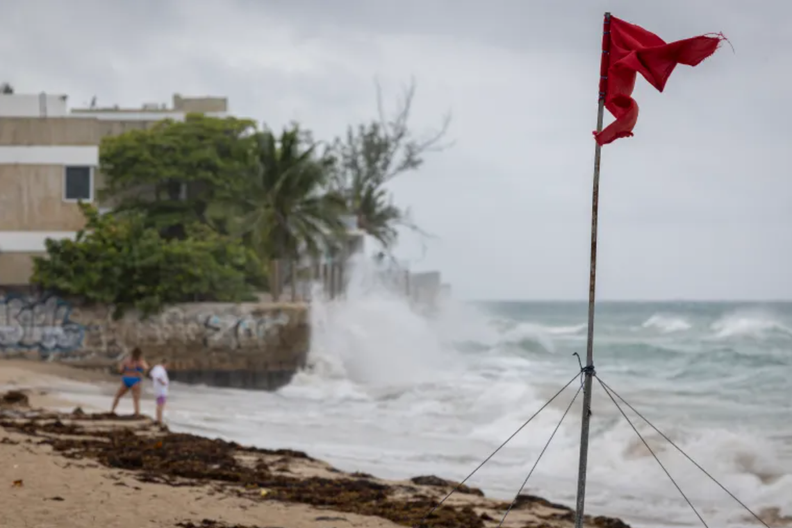
The NHC said swells generated by Erin are already impacting the northern Leeward Islands, the Virgin Islands, Puerto Rico, Hispaniola and the Turks and Caicos. These powerful waves are expected to spread further north and west, reaching the Bahamas, Bermuda, the eastern seaboard of the United States, and parts of Atlantic Canada early to midweek.
Officials caution that these conditions could create life-threatening surf and rip currents, even in areas not directly in Erin's path.
The Bahamas Meteorology Department, which also monitors weather for the Turks and Caicos Islands, has issued a Tropical Storm Watch for the British territory as Erin's outer bands approach.
Season's fifth named storm
Erin is the fifth named storm of the 2025 Atlantic hurricane season, which runs from June 1 to November 30. Meteorologists say this year's season has the potential to be unusually active, with unusually warm ocean waters fueling stronger cyclones.
Although Erin has weakened, forecasters are monitoring its trajectory closely. The hurricane's exact path remains uncertain, but its size and power mean its effects will be felt far beyond its center.
Secondary risks: wildfires on land
Beyond coastal hazards, Erin could also increase the risk of wildfires under the right conditions, meteorologists warn. If the system intensifies into a powerful offshore storm, colliding warm and cold air masses could generate strong, dry winds over land.
"Such winds, combined with already parched vegetation, could turn a single spark into a fast-moving blaze," said Andrew Siffert, Senior Meteorologist at BMS Group. He added that while the risk is conditional, it highlights the wider knock-on impacts that large storms can have, even without making landfall.
A watchful week ahead
Communities across the Caribbean and along the US East Coast are being urged to stay alert, with authorities emphasizing that Category 3 storms remain highly destructive. The combination of rough seas, rip currents, and the potential for shifting tracks means Erin could bring significant disruption well into the week.
Do you want me to also add context about how Erin compares with early-season hurricanes historically (e.g., stronger-than-average start, climate trends)? That would give it a more Guardian-style depth.