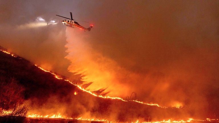
Fire weather conditions are determined primarily by two factors: available fuel—such as grasses, shrubs, and trees—and wind patterns. In Southern California, Santa Ana winds play a crucial role, carrying dry air from the deserts toward the coast, significantly increasing wildfire risk.
Immediate Threat: The Next Three Days
A stalled low-pressure system offshore is expected to bring another round of strong Santa Ana winds this week. The U.S. National Weather Service (NWS) in Los Angeles has raised its fire weather outlook to a "particularly dangerous situation," the highest alert level. Officials are warning residents against any activities that could spark new fires, as human activity accounts for approximately 95% of California wildfires. While arson is rare, fires are frequently ignited by accidents such as dragging trailer chains, downed power lines, and discarded cigarettes.
Wind gusts in Ventura and Los Angeles counties could reach speeds of 70 mph between Tuesday morning and Wednesday afternoon, with relative humidity levels dropping as low as 5%. These conditions will likely lead to erratic fire behavior, allowing burning embers to travel long distances and start new fires. Ventura County may experience fire conditions worse than last week's blazes, which were fueled by similarly powerful winds.
Fuel dryness—a key measure of fire risk—is also reaching extreme levels for this time of year, surpassing what is typically seen at the height of the summer wildfire season. These dry conditions now extend from Southern California up the central coast and could soon impact the Bay Area as well.
Looking Ahead: The Next Three Weeks
Southern California's rainy season is experiencing historically low precipitation levels, running at just 2% of normal in Los Angeles. Since October, the city has received only 0.16 inches of rain—more than four inches below the seasonal average.
Weather models suggest that no significant rainfall is expected for the remainder of January, and early February may remain dry as well. This is highly unusual, as January and February typically account for over half of Los Angeles' annual rainfall, averaging more than 7 inches out of the city's usual 13-inch total. Even in 2006-2007, the driest year on record, Los Angeles still received over 3 inches of rain.
With prolonged drought conditions and continued exposure to Santa Ana winds, out-of-season fire weather is expected to persist. Some long-range models indicate that a blocking weather pattern could set up, redirecting Pacific moisture away from California, further intensifying the drought.
Long-Term Outlook: The Next Three Months and Beyond
According to the NWS, drought conditions worsened across Southern California last week and are expected to persist through at least March. This extended dry spell follows two unusually wet years, which saw more than 25 inches of rain fall in consecutive rainy seasons. While this rain helped replenish reservoirs, it also promoted the rapid growth of shrubs and grasses, now acting as abundant fuel for wildfires.
If and when rain does return later in the year, it may arrive in the form of atmospheric rivers—intense streams of moisture that can trigger severe flooding and mudslides, particularly in areas recently scorched by fires such as the Palisades and Eaton fire zones.
Compounding these concerns, La Niña conditions officially developed in early January in the tropical Pacific Ocean, a phenomenon historically linked to drought years in Southern California. Seasonal climate forecasts for the next seven months predict between 4-7 inches of rain for the remainder of the rainy season, with a possibility of even lower totals.
If this forecast holds, dangerous fire weather conditions may persist well beyond the winter months, stretching into the summer and potentially spreading north across California. With prolonged drought, increasing temperatures, and persistent wind events, experts warn that the state's wildfire crisis is far from over.